

Local History
Antony Carpen is our local historian and has written a number of articles about the history of the Queen Edith’s area, some of which can be seen here:
Olivia Newton-John's family during their Cambridge days. https://lostcambridge.wordpress.com/2025/10/12/brinley-newton-john-and-family-in-london-1949/
Local MP Hamilton Kerr and the rollout of new phone lines in Queen Edith's. https://lostcambridge.wordpress.com/2024/11/10/hamilton-kerr-mp-in-queen-ediths/
The Junction's creation. https://lostcambridge.wordpress.com/2019/03/01/direct-action-by-cambridge-teenagers-in-1985-leads-to-the-construction-of-the-junction-arts-centre/
Robert Davies MP of Beaumont Road. https://lostcambridge.wordpress.com/2021/01/24/cllr-robert-davies-mp-candidate-for-cambridge-labour-party-1964/
Abandoned move of Morley School in the early 1970s. https://lostcambridge.wordpress.com/2023/12/07/the-proposed-move-of-morley-memorial-primary-school-to-baldock-way-allotments-1973/
The naming of Hills Road and Long Road Sixth Form Colleges. https://lostcambridge.wordpress.com/2024/09/28/whats-in-a-name-how-hills-road-and-long-road-sixth-form-colleges-got-their-names-1973/
Kathleen Hartley of Hills Road - education campaigners. https://lostcambridge.wordpress.com/2023/07/22/kathleen-hartley-cambridges-educational-amazon-1972/
Brinley Newton-John also of Hills Road. https://lostcambridge.wordpress.com/2020/06/15/brinley-newton-john-headmaster-of-the-cambridgeshire-high-school-for-boys-today-hills-road-sixth-form-college/
The opening of Morley School Part 1. https://lostcambridge.wordpress.com/2021/04/24/the-opening-of-morley-memorial-primary-school-purpose-built-for-homerton-college-cambridge/ and part 2 https://lostcambridge.wordpress.com/2021/04/25/the-opening-of-morley-memorial-primary-school-purpose-built-for-homerton-college-cambridge-part-2/
Kathleen Hartley. Cambridge’s ‘Educational Amazon’ – 1972
“Capturing Our History” in Queen Edith’s
Roger Lilley writes: A big thank you to everyone who has helped get the Queen Edith’s Community Forum’s history project off the ground. It is part of the wider Capturing Cambridge project run by the Museum of Cambridge. Since I started uploading information at the end of June 2016, I have been helped by amateur historians, local residents and the resources of the Cambridge Collection in the Central Library. Many interesting snippets have emerged: the crash landing of a World War Two bomber where Wulfstan Way is today, the home of the founder of the Royal College of Veterinary Surgeons in Rock Road, the strange tale of popular Captain Heal whose love of fame caught up with him and who was sentenced to three years for embezzlement in 1914.
The project also sets out to use the national census data to show who lived in the older houses of Queen Edith’s, their jobs and households. We know that in Josiah Bowyer’s modest house in Blinco Grove, a family of 15 lived in 1891. Many households had at least one servant, some as young as 13. As well as railway and post office workers, gardeners, carpenters and college servants, there were also umbrella and banjo makers.
Finding photos to tell the stories of these families is more difficult. I am collecting some vivid oral histories, but there are few contemporary photos. I have used some pictures of buildings in the area, and sometimes have been lucky to find portrait photos of the more celebrated, but I am eagerly seeking pictures that are more closely associated with addresses and families.
I would like to include more recent history, in particular the stories of those who have moved into Queen Edith’s over the years, especially from abroad and have a story to tell.
This is just a start and I hope I will continue to get messages in my in-tray with new anecdotes, offers of interviewees, as well as corrections and amendments. A lady who now lives in Canada contacted me recently to point out that the WWII Italian Prisoner-of-War camp wasn’t quite where I had placed it, but down Walpole Road. Thank you!
If you have contributions, short or long, or would like suggestions of how you could contribute to the project please do contact me. Please also send feedback about the Capturing Cambridge site to the Museum of Cambridge who are very keen to improve it in the light of user comments.
Roger Lilley – 71 Holbrook Road, Cambridge CB1 7SX
Email: queenedithshistory@gmail.com
Jeremy Lander has written this explanation of who Queen Edith was:
Calling this area ‘Queen Edith’s’ is a relatively recent invention. The City Council ward of that name only came into being in 1976, and was named after Queen Edith’s Way, which runs through its centre. But Queen Edith’s Way only took on its name early in the twentieth century; before that, the road was known as Trumpington Drift.
Why Queen Edith’s Way? Well, the land around what’s now Wulfstan Way, down to Worts’ Causeway, was (and partially still is, surprisingly) owned by what is now Guy’s and St Thomas’ Charity. This land has been in the same hands since it was given to St Thomas’ Hospital, London in the 16th century. Prior to that, it had been held by a succession of landowners, the most notable being one Edith ‘Swan-Neck’, or ‘Eddeva The Fair’, in the 11th century.
Edith Swan-Neck was a princess of Danish stock. From recent research by historian Bill Flint, we now know her to be the granddaughter of Aethelred the Unready, her mother being Wulfhilda, daughter of Aethelred’s first wife Aelgifu. She was heiress to an enormous amount of land dotted around East Anglia but principally in this area of Cambridgeshire.
In about 1042 she married Harold Godwinson, Earl of East Anglia, in a ‘handfast’ or common-law marriage. This practice was frowned on by the church but common in Danish and Saxon nobility. Harold and Edith had a long and successful union, producing six children. However, although Harold eventually became King Harold II, in 1066, Edith was considered only to be his mistress, and not technically a queen. Harold was killed soon afterwards at the Battle of Hastings.
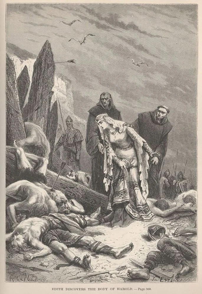
Edith discovers the body of Harold – Illustration from History of France by François Guizot
When the upper part of Trumpington Drift (leading from Hills Road) was named Queen Edith’s Way in the 1920s it is possible that the connection was misunderstood and they gave it the title ‘Queen’ thinking that the land was owned by a better-known (and true ‘Queen’) Edith, wife of Edward the Confessor (the previous king) and sister of Harold.
After the rest of Trumpington Drift was renamed Queen Edith’s Way in the 1930s, and the area developed for housing after the Second World War, other Saxon names were used for local roads and schools. These had varying degrees of connection to Edith Swan-Neck. So while it’s true that Godwin and Gunhild were two of Harold and Edith Swan-Neck’s children, a much more significant Godwin was Harold’s father, Earl Godwin of Wessex. Wulfstan was Bishop of Worcester, a Christian saint, and a supporter of Harold and the whole Godwin family.
Queen Emma (who gets a road and a school named after her) has the least connection with the area. She was Aethelred the Unready’s second wife and, with her second husband King Cnut, was a parent of Edward the Confessor. In other words, she was ‘our’ land-owning Edith’s sister-in-law’s mother-in-law!
Does all this matter? Why would we need to be reminded that a Danish princess once owned this land? Does it help to enrich our experience, knowing that the bones of this story lie just beneath the streets and gardens which at first glance appear so very ordinary?
If nothing else, perhaps knowing a little more about what lies under the surface will remind us that in our landscape nothing appears from nowhere. Look hard enough and there is a story behind everything.
Watch Jeremy Lander’s online talk on The History of Queen Edith’s here: https://youtu.be/cuNuWHU4YVU